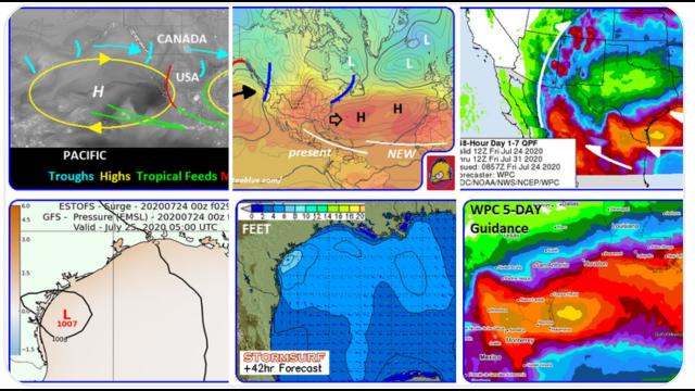
Tropical Storm Gordon could become a Hurricane IMHO
Description
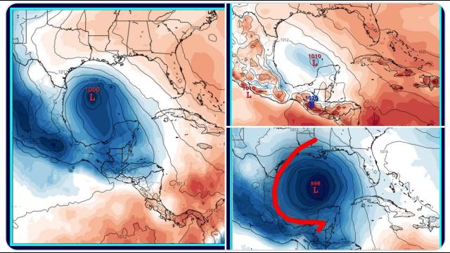
No models have it becoming a hurricane but temps are 86 & wind shear is low. So that doesn't make sense to me.
God bless everyone,
T
https://www.paypal.me/THORnews
Tshirts
https://hitthebuttonbaby.com/
THORNEWS
PO BOX 35946
HOUSTON TEXAS
77235-5946
the crankywxguy blog
http://www.stormhamster.com/entry/e090218.htm
the wave master
https://dabuh.com/
dadabuh surf video
https://www.youtube.com/watch?v=bHKV-ry7JsU
https://weather.com/storms/hurricane/news/2018-09-02-tropical-storm-hurricane-florence-atlantic-ocean
Tropical Storm Florence is now well west of the Cabo Verde Islands.
It will track into the central Atlantic Ocean over the next one to two weeks.
Tropical Storm Florence is moving toward the west-northwest through the open Atlantic Ocean after brushing the Cabo Verde Islands with rain and gusty winds.
Florence will not affect any land areas for the next five days and is forecast to maintain its intensity as a tropical storm.
Wind shear and dry air are inhibiting strengthening for now, but conditions may become more favorable for intensification in about four or five days.
Forecast model guidance is indicating Florence could be roaming the Atlantic Basin for the next one to two weeks.
We are confident that Florence will never pose a threat to the Caribbean given how far north the storm is already and its continued west-northwestward track.
For now, it's too early to determine the long-term track of Florence beyond five days since that will depend on the evolution of the upper-level weather pattern. Subtle details in how the long-range weather pattern sets up will determine Florence's future path, potentially into September's second week.
A recent shift in some forecast guidance is indicating Florence may track farther west than initially expected. Therefore, we will continue to monitor Florence closely since further shifts westward could bring it closer to Bermuda or the United States.
Florence is nothing to be concerned about at the moment, but it's a reminder we are in the peak of hurricane season, and every storm must be monitored closely for changes.
Check back with weather.com in the week ahead for more details on Florence.
If you live in a hurricane-prone location, now is a good time to make sure you have a preparedness plan in place.
Tropical Storm Watches Issued for Northern Gulf Coast Ahead of Potential Tropical Cyclone Seven
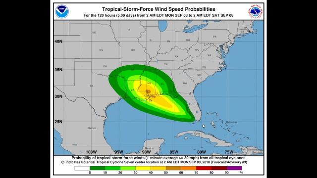
Potential Tropical Cyclone Seven in the Bahamas will move into the Gulf of Mexico early this week.
Tropical storm watches have been issued for portions of the northern Gulf Coast.
Potential Tropical Cyclone Seven will spread heavy rain into southern Florida before entering the Gulf.
This system is likely to develop into a tropical depression Monday, then a tropical storm Monday night.
Heavy rain will be the main impact for the northern Gulf Coast.
Gusty winds, rip currents, high surf and some coastal flooding are also possible impacts.
The National Hurricane Center initiated advisories on Potential Tropical Cyclone Seven late Sunday, triggering tropical storm watches for portions of the northern Gulf Coast.
The declaration of a "potential tropical cyclone" by the NHC allows advisories to be issued on systems that have yet to develop but pose a threat of bringing tropical-storm-force winds to land areas within 48 hours.
The NHC expects this system to become a tropical depression Monday and a tropical storm Monday night as it moves into the southeastern Gulf of Mexico and tracks toward the northern Gulf Coast, where heavy rain, gusty winds and rough surf will be potential impacts by midweek.
Potential Tropical Cyclone Seven is currently located in the Bahamas, where it is producing numerous showers and thunderstorms.
An Air Force Reserve reconnaissance aircraft is scheduled to investigate the system Monday to help determine whether it has become a tropical depression.

